Soil Scanning
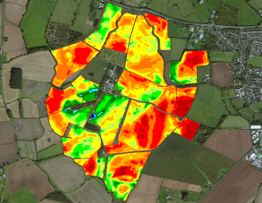
The EM38 Scanner is able to analyze the terrain by moving over the ground and without the influence of any field limitations (ploughs, tall weeds, unevenness, etc.). Soil moisture is an important element in creating extensive data maps, so autumn to spring is the ideal time for the data collection period.
Because scanning is a one-time process and an investment for future field management, we collect high-precision data to create highly detailed maps:
A special trailer is attached to a tractor or a car, and the scanner is connected via bluetooth to a special monitor installed inside the car and starts collecting data together with GPS.
The combination of these factors means that the conductivity data collected and the maps produced provide you with reliable, digital and detailed farming information.
When you use the maps and data provided by the scanner, our team will provide you with a report as part of the service. The obtained data and maps can be used for various purposes:
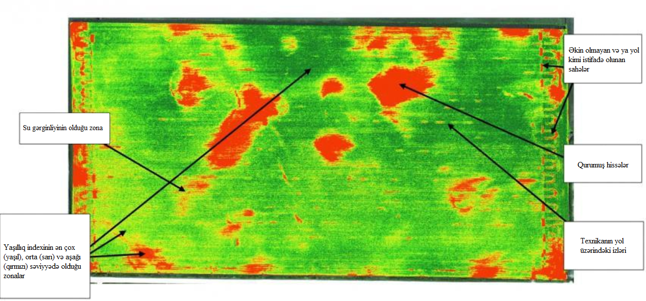
- Distribution area and topography of physical and chemical indicators in the soil (Macro and Micro elements, as well as EC, pH, soil texture)
- Management map to match fertilizer and planting to soil characteristics
- Comparison of the area between previous years soil indicators and scanned map resu